Sunday, December 28, 2008

This is the Sea 4


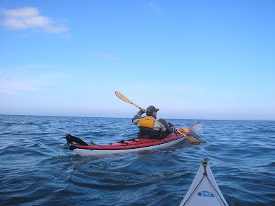
These are two photos from Justine Curgenven's photo gallery. The shipwreck was used as a partial shelter for a short break, during the circumnavigation of Queen Charlotte Islands. This was one of two expedition documentaries making up the newest DVD in Justine's series: This is the Sea 4 disc 2.

This is the Sea 4 provides us with another motivational sea kayaking DVD showcasing local people, culture and paddlers who live and paddle in unique regions of the world.
Disc one starts off in Baja, New Mexico. Justine creates interesting opportunities to gain insight into paddlers' experiences and skill, often letting them do the talking. As a result Justine takes on the role of narrator for many of these visits,and it is this relaxed approach that allows us a unique view into the places and different lives of paddlers. Viewers actually become part of the trip. This style of filmmaking is fascinating for those of us who find it difficult to actually get to Baja, Australia or Norway. When we catch up to Dubside in Washington - we learn when he was born, his real name was Dubside - his parents just didn't know it. We follow him to several of his rolling destinations, typically accessible by bus and finish with what he calls commando kayaking.

We next visit Jim Sammons and friends Kayak Fishing in the San Diego region. There is an abrupt shifting of gears, and Justine leads us on a 350km crossing of the Bass Strait between mainland Australia and Tasmania.

Then something entirely different on the Ottawa River - Ken Whiting and Brendan Mark(Canadian whitewater experts) take Justine down whitewater in seakayaks.

Viewers share in the travel adventures to these and other locations - Israel, Norway and Lake Superior where the scenery and locations are extraordinary and the stories behind the paddling are captivating.

Basically two and half hours of action. You will want to visit these places by the time you finish watching this DVD.

Merry Christmas!


This time of year is a great time to visit family and friends, celebrate, practice those tricky yoga moves but also to catch up on reading.
I just discovered reviewing the Iles de la Madeleine tourism newsletter that the islands have launched their own water trail. I think we just missed the grande opening when we were there.

Prepared by the Centre intégré de développement touristique des Îles de la Madeleine (CIDTIM), in close collaboration with the Municipalité des Îles-de-la-Madeleine and the Îles-de-la-Madeleine ZIP Committee, the Water Trail Maps show 31 duly authorized launch sites. Used along with nautical charts, these maps provide all the pertinent information required to plan a safe excursion around the archipelago. The Maps, presented in both official languages, illustrate the suggested circuits and offer advice about local navigation conditions, distances between launching sites, special local conditions and services available to users.

This project is a part of the CIDTIM's 2008 action plan and fits neatly into the objectives of the overall tourism development policy of the Municipalité des Îles-de-la-Madeleine. Based on the concept of responsible tourism, this mapped (but unmarked) trail is designed to:

Prevent the deterioration of natural habitats by protecting them from uncontrolled traffic
Promote friendly relations between users and owners of waterfront properties
Improve safety for users
Create a new attraction, a new awareness and accrued economic benefits for the tourism industry.

This project was made possible through the partnership of Canada Economic Development, the Caisses populaires Desjardins des Îles, the Centre local de développement des Îles-de-la-Madeleine and the participation of members of the Regional Tourism Association.

I am definitely going to have to go back.

But it may also motivate the development of water trails in Newfoundland and Labrador. The idea came up at one of our recent AGMs and now with the Iles de Madeleine launch there may be renewed interest.

Saturday, October 18, 2008

East Coast Trail - Fundraiser and Birthday Bash


Today we hid away the kayak gear for the day and took time out to support the East Coast Trail Association. Today was their annual fundraiser and 14th anniversary of their founding. What a day to celebrate!! Volunteers have done an incredible job not only on this section but all of the kms of trails around this part of Newfoundland. The ECTA organized a double decker bus early this am,drove us to Logy Bay and we hiked from the Ocean Sciences Centre to Quidi Vidi.
It happened to be a brilliant day - sun shining, no fog, no rain; so the event was really enjoyable. Despite two breaks to enjoy the scenery while sipping a coffee and numerous stops for photos, we made quite good time coming in around 3.5 hrs.

Saturday, September 27, 2008

Conception Bay


Today was an extraordinary day - warm and very calm.
We launched from a beach in Foxtrap and paddled over and around Kelly's Island.
A fair bit of traffic on the water with sailboats and all types of power boats launched - many for a chance of hooking some cod.

Saturday, September 20, 2008

the End of the Season


The season of baseball,at least in the St.John's region is drawing to a close.
Today, though windy was a perfect baseball day for watching the senior semifinals Shamrocks vs Holy Cross.

Jelly fish


I was intrigued this past summer to find an exhibit at the Metro Zoo that featured moon jelly fish. Who would have thought they would warrant their own section/aquarium with a special viewing glass? They seem a bit common place here and folks paddle over and around them without much thought. They are however, quite amazing creatures and no doubt we will be seeing more of them. A number of us came across a "bloom" of them a while ago just a short distance off shore in Trinity that was quite incredible. Not just a half a dozen but hundreds - extending out in a semi-circular shape about 8m long but more interesting layered upon each other 4-5 m deep. One of the members of our KNL newsgroup reminded me of these photos when he provided a link to Dave Gallo's talk, this is a video worth reviewing.

http://www.ted.com/index.php/talks/david_gallo_on_life_in_the_deep_oceans.html

Friday, September 19, 2008

Fatal Tide


I found this book to be quite an extraordinary investigation of a tragedy we read about, but hadn't experienced.
David Leach makes you feel you were part of the race. His descriptions of the location, race and the main characters gives you a sense that you actually knew them.
Fatal Tide may have even more meaning if you have paddled in the Bay of Fundy area or have ever volunteered to cover an adventure race.
David also deals with a number of practical issues such as:hypothermia, cold shock and attempts to explain how these physiological events impacted racers.
If you get a chance give this book a read.

The Swell


One of my favourite shots - Paul H took this one. Usually the sea flattens out somewhat when you are taking these shots - but not when you are at the bottom looking up.

Sunday, September 14, 2008

Avalon Dragon Boat launch


I witnessed an incredible event this afternoon - the launch of two dragon boats. One of them hand made by women who have survived breast cancer. This project started 18 months ago.
It is hoped that dragon boat racing will be a regular event.
Congratulations to the Avalon Dragon boat racers. It looks like the permanent home will be in the town of Paradise on Octagon Pond. It is positive to see that kind of support in the community.

Middle Cove


The marine forecast forced the regularly scheduled event for KNL to be cancelled. The incredibly sunny day couldn't keep us off the water even for a short time. No real wind to speak of but swell was rolling in nicely. We launched from Outer Cove and made our way out a fair distance heading for Torbay. We puttered around for a while in what was quite a significant swell. It doesn't always look like much from the photos, but it creeps up on you like a slowly moving roller coaster.

Beaufort Scale


Following our last paddle there was considerable discussion about weather, forecasting and decision making about starting our trip in the first place, especially since there were some novice kayakers among the group. The group leaders made a choice to proceed with a good understanding of the current weather and the forecast for later in the day. There was no objection voiced from any of the experienced paddlers at the time of the departure to the takeout nor any disagreement as we left the wharf. All safety measures were taken including assignment of sweeps and assistants and four experienced paddlers had VHF radios. The photos at the start suggest wavelets on the water, and not enough wind to extend the flag.
The Beaufort Scale can be a useful tool in combination with knowledge of where one is going,skill level and duration of the trip.
I would estimate the Beaufort Number to be 2 when we left.
Since weather forecasting is not always reliable in this region we have to keep vigilant about the conditions and that was why we headed back early and avoided the final section of the paddle. The wind direction and our location kept the group fairly close and manageable until we hit the turn around the final headland.
At the turn the Beaufort was 3-4 and as we headed into the final stretch a 4 on the scale. Waves were less than a metre, but it was understandable some of the novices were a bit worried and even some intermediate paddlers were apprehensive. At one point one novice paddler blew her whistle as she was uncomfortable but not in immediate trouble. Experienced paddlers would have just been having fun but in this case were assisting the newer paddlers.

Since novice paddlers are just beginning, their comfort zone is very limited - making sure enough time is allowed to reach a protected area will minimize discomfort and angst among the group and ensure novices return to paddle another day. I think this was done, I discussed it with the team leader at a break and we left early enough so that we would come under the predicted increased winds for the evening.

I have found keeping this scale in mind helps me understand how wind speed affects me on the water. As well it gives a good predictive idea of what you are going to be doing. If you see white caps as you are driving in to the take out - you know it is going to be a good workout and if you aren't physically and mentally up for it you have to let your fellow paddlers know.

Two books to check out:
Lull J: Sea Kayaking Safety and Rescues. Wilderness Press, Berkeley 2001
Where the Wind Blows A Guide to Marine Weather in Atlantic Canada, Breakwater 1995

Saturday, September 13, 2008

Rantem Paddle


Chance Cove to Rantem paddle.
Kayakers are dwarfed by great stacks and cliffs.
Click on photos to enlarge - I didn't recognize Tony until the middle photo was enlarged and didn't see kayakers going around the stack in the bottom photo until I looked closer - bottom right.

Sunday, September 7, 2008

Chance Cove


What a great paddle!
One of the largest groups ever - 38 folks made their way to Chance Cove slipway and departed for Rantem. On the way, great views and at least one large eagle perched briefly and soaring overhead.
We had lunch just before Rantem on a rather large beach,one of the few that could accomodate all 38 kayaks and then made our way slowly back anticipating a bit of an increase in wind.

Wednesday, September 3, 2008

World Physical Therapy Day


September 8th has been designated World Physical Therapy Day.
Working with people to promote wellness, mobility and overall health.

Check out: www.wcpt.org

Thursday, August 28, 2008

Olympic Summary


These games were quite an extraordinary event. I think I was just as interested by the behind the scene stories, interviews with the Chinese people and individual quests for personal performance bests; than by the competitions. Interviews and commentaries from correspondents suggested that the this Olympics allowed the Chinese people more opportunity to speak to outsiders than ever before.Through a magazine article I met Donnie Pei. Donnie Pei is a Beijing native who did a degree at UWO, through the International Centre for Olympic Studies. He indicated that prior to 2000 very few in China had any knowledge of the Olympics. It seems a universal flaw in the Olympic movement that governments tend to inject their own agenda into the event- this seems to be the case in Beijing. Many decisions on development and training had the gold medal as a measure of success and this may be more a reflection of how new the Olympic movement is to China. While gold medals were a fixation by Chinese sports officials, the very few bronze medals in China suggests a poor overall base of sport involvement. Canada's philosophy is more driven by a plan articulated in a Sport Canada document entitled Sport for Life. It makes infinite more sense to promote sport for the inherent values of fair play, focus, direction and ultimately good health. These are elements that can be promoted for a lifetime.
And the games are not finished we are now seeing some incredible athletes participating in the Paralympics.
Check out:
http://www.cbc.ca/sports/paralympics/story/2008/09/04/paralympics-flag-bearer.html?ref=rss

Sunday, August 17, 2008

Cape Broyle


The falls on the north side of Cape Broyle were in full force today, not unexpected given the amount of rain we have had for the last week or two, but always worth checking out as close as you can manage.
Low tide and a close look along the shore revealed lots of sea urchins for the gulls.